The Openmoji Atlas was made from the Openmoji set. Check our previous series “The Emoji Atlas” made from the Twitter set. There are even more sets collected by Emojipedia.
“Emoji are indispensable for daily communication. They are practical (👍), funny (😆) and sometimes quite bizarre (💩🤪🙀🧟). For us, emoji are much more than colorful images decorating fun short messages. We think they are rather part of an important and exciting development: the return of pictorial symbols to written communication. For the first time in history, it is possible to communicate with a combination of letters and icons. Now it becomes feasible to say things and convey meanings that were previously impossible.”
Read more about openmoji project:
https://openmoji.org/about/
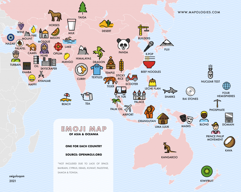
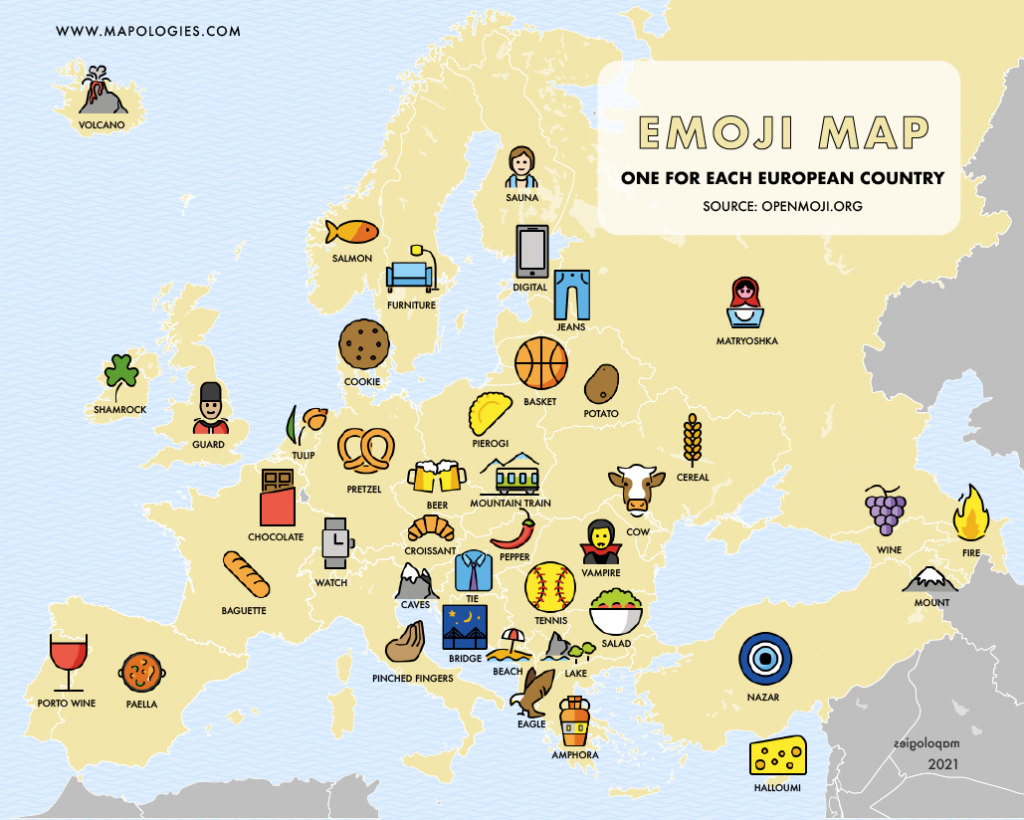
In this atlas, we tried to assign one different emoji for each country, if there was enough space. They might repeat in different continents. The emoji sets allow us to visualize the stereotypes and their distribution. Some regions of the planet are almost invisible. Moreover, the aspect of each emoji can vary greatly from one set to another. It is not possible to substitute them completely.
Africa

America

Asia & Oceania
Europe

Could do a detail map of the Caribbean to fit everybody in